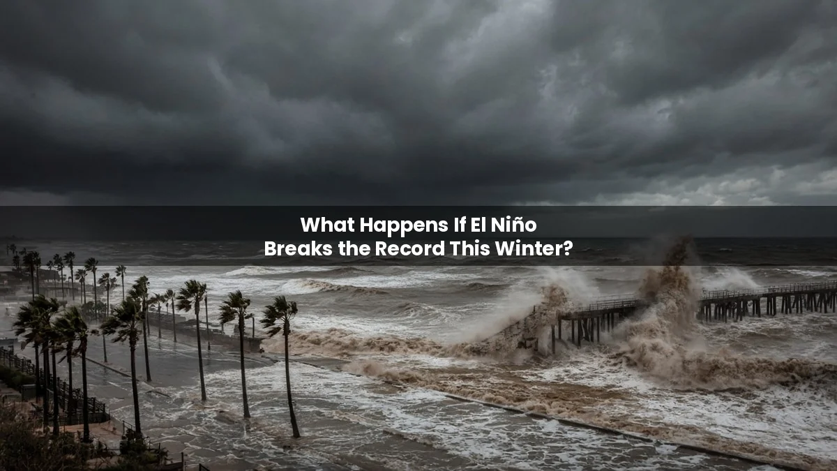
What Happens If El Niño Breaks the Record This Winter?
The Pacific Ocean is running a fever not seen in modern records. Side-by-side maps of El Niño 2023 and El Niño 2026 hit Reddit’s front page this week, and the UN chief called it a “supersized El Niño” at the COP31 climate summit. So what actually happens if this one breaks the record?
Short answer: NOAA gives roughly 70–83% odds that this El Niño becomes the strongest since records began in 1950, likely peaking around December. A record event won’t create brand-new kinds of weather. It loads the dice harder toward the usual El Niño pattern: a wetter, stormier southern US, a milder northern US and Canada, a higher risk of heat and drought in parts of Australia, and a global temperature spike that could make 2027 the hottest year on record.
We separate measured facts, official forecasts and speculation below.
How strong is El Niño right now?
Status: measured (NOAA Climate Prediction Center, 9 November 2026).
- Current reading: sea surface temperatures in the key Niño 3.4 region were 2.3 °C above average in the latest weekly data. Off South America (Niño 1+2) they were 4.7 °C above average.
- Official index: NOAA’s Relative Oceanic Niño Index (RONI) for August–October was about 2.0 °C. That is close to the pace of the 1997 event. The record three-month value in NOAA’s database is 2.4 °C, set in December 1982 to February 1983.
- Advisory: NOAA keeps an El Niño Advisory in place and says a strong-to-very strong event is likely through January–March 2027, with more than an 83% chance.
- Already visible: the 2026 Atlantic season produced only one hurricane, the fewest since 1925, according to weather.com. El Niño’s wind shear suppresses Atlantic storms.
Will it really break the record?
Status: official probability forecasts.
NOAA puts the chance of a “historic event”, a three-month RONI of +2.5 °C or more, at 83% for October–December and 70% for November–January. Australia’s Bureau of Meteorology also expects the event to beat 1982–83, possibly topping 3.0 °C above average in the central Pacific. The Met Office’s long-range system has shown values above 3 °C, and its head of long-range forecasting, Adam Scaife, called it “an unprecedented event.”
Climate scientist Zeke Hausfather has suggested it may be the strongest El Niño in about 1,000 years, based on tree-ring and coral evidence. That is an expert estimate from proxy records, not an official ranking.
What happens in the US and Canada this winter?
Status: NOAA seasonal outlook (probabilities, not guarantees).
- Wetter south: NOAA favors above-normal precipitation for much of California, the Southwest, the southern Plains, the Southeast and Florida. Florida and the Southeast have the strongest wet signal.
- Warmer north: above-normal temperatures are favored for the northern tier, the western third of the US and eastern Alaska, with the highest odds around the Great Lakes and upper Mississippi Valley.
- Already happening: weather.com reports a record-wet fall through early November in Albuquerque, Flagstaff and West Palm Beach, plus record warmth in cities such as Chicago, Dallas and Houston.
- Canada: strong El Niño winters have historically leaned milder than normal across much of western and central Canada. Typical pattern, not a forecast for every region.
Heavy rain and coastal storms can mean flooding and outages. For what to do when the lights go out, see what happens during a storm power cut. A warm, soggy pattern can still be interrupted by Arctic outbreaks, as we explain in what happens if the polar vortex collapses.
What happens in the UK and Australia?
Status: agency guidance.
UK: the Met Office expects El Niño to raise the chance of wetter, stormier conditions across north-west Europe, including the UK, in autumn and early winter. The signal is weaker in Britain than in the Pacific, so local weather can still surprise.
Australia: El Niño often brings warmer, drier conditions, but the Bureau of Meteorology stresses that “El Niño strength doesn’t always match impact.” Other drivers, especially the Indian Ocean Dipole and record-warm oceans, can boost or cancel its effects. The bureau warns that a warming climate raises the risk of heatwaves, flash drought and dangerous fire weather this summer.
What happens to global temperatures?
Status: WMO data plus Met Office projection.
The World Meteorological Organization says January–September 2026 averaged about 1.47 °C above pre-industrial levels. El Niño typically adds 0.1–0.2 °C to global temperatures, and it hits hardest in the year after it peaks. The Met Office says 2027 is “very likely” to replace 2024 as the warmest year on record and temporarily exceed 1.5 °C.
WMO chief Celeste Saulo summed it up: “El Niño doesn’t add new heat to the planet. It releases heat from the ocean, which is the warmest ever measured.” The WHO has, for the first time, classified the expected health impacts of an El Niño as a health emergency, citing heat, smoke, food insecurity and diseases such as dengue and cholera.
Water stress is part of that picture. For the extreme version, read what would happen if water disappeared from Earth. A record El Niño also lands in a world already close to the 1.5-degree line. See what happens if global warming passes 1.5 degrees.
Myths and hype to ignore
- “A super El Niño means a disaster everywhere.” Misleading. Impacts are probabilities. Some regions see little change, and a few benefit, such as fewer Atlantic hurricanes.
- “El Niño is caused by climate change.” False. El Niño is a natural Pacific cycle. Climate change adds heat on top, which is why experts call it a “risk multiplier.”
- “It will last for years.” Unsupported. NOAA expects El Niño to persist into spring 2027, with neutral conditions favored by April–July.
When will we know?
NOAA updates its official El Niño outlook on the second Thursday of each month; the next update is due 12 November 2026. The record would be confirmed only after the three-month averages are in, likely in early 2027.
See more Earth scenarios in our what would happen if scenarios hub.
Frequently asked questions
What is a super El Niño?
It is an informal name for a very strong El Niño, usually when Pacific temperatures run 2 °C or more above average. Scientists prefer “very strong” or “historic.” NOAA’s record threshold for this event is a three-month RONI of +2.5 °C.
Is El Niño 2026 stronger than 2023?
Yes, by a wide margin. The 2023–24 event was moderate to strong. The 2026 event is already near the 1997 pace and is forecast to set a record.
Does El Niño mean a mild winter?
For the northern US and much of Canada it often does, but not always. The southern US usually turns wetter and cloudier instead.
When will El Niño 2026 end?
NOAA expects it to fade through spring 2027, with neutral conditions favored by mid-2027.
Does El Niño affect the UK?
Weakly. The Met Office says it raises the odds of wetter, stormier spells in autumn and early winter, but other factors usually matter more.
Sources
- NOAA Climate Prediction Center: ENSO status and predictions (9 Nov 2026)
- NOAA CPC: Seasonal outlook discussion (Nov–Jan 2026–27)
- WMO: State of the Climate Update 2026 (9 Nov 2026)
- weather.com: Super El Niño nearing a record (5 Nov 2026)
- Met Office: An “unprecedented” El Niño and the UK
- Bureau of Meteorology: El Niño strength doesn’t always match impact on Australia